Where's Bertie? He's still at Bennet's Wood Farm.
Weather: Overcast and cooler than the last few days, but hardly any breeze.
Last night, for the first time ever, I set the timer on Bertie's heating so that it would be warm by the time we needed to get up this morning (the temperature for the last two nights have been low single digits, giving us a morning internal temperature of around 8 degrees). I didn't trouble myself to read the instruction manual, but had a play with the control panel and the settings seemed simple enough to implement. Or so I thought. The lack of heat when I woke up suggests I may have to read the manual after all.
It was quarter to eight by the time we stepped into the cool of the morning and headed off down the road. Only two steep uphill pulls were to feature in our day, and the first came within the first 10 minutes. That got the circulation going!
There were no flying golf balls to heed as we crossed four fairways of the golf course, and before long we were passing the place where we had turned back towards Bertie on yesterday's walk. Today we were going significantly further, so onwards along The Ridgeway long distance path we went.
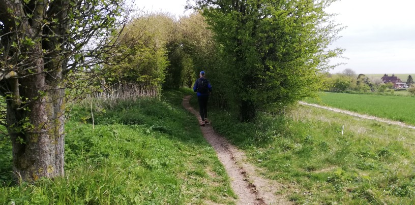
 Motor vehicles are banned from the Byway between 1 October and 30 April, so the state of the ruts wasn't too bad.
Because The Ridgeway doesn't feature much ascent and descent, I'd decided that rather than running out for 20km and returning the same way, we would turn well before half way and throw in three loops on the way back, like this:
 The plan and the reality weren't far adrift
All went swimmingly until a junction where the only Ridgeway sign was back the way we'd come. I looked at the map and declared that our way was straight on. It was only as we approached a road that I realised we had strayed from our intended path, although to no detriment as we'd accidentally done one of the return-leg's loops in reverse and a bit early.
 A treadmill for horses, with all 4 bays in use as we passed
 A place we were supposed to be, but not at that point in the route
The map had made it clear that it's racehorse country around here, and by now we were starting to see the adjacent gallops in use.
Having made it to the furthest point of the route, back on ourselves we came, ignoring the first loop (which we'd already done), but making sure to take the second. I'd done a fair bit of research last week trying to find somewhere we could buy food and water, so as not to need to carry a whole day's supplies with us, and the only place I found was the village store in Compton; it was thus imperative that we didn't omit that loop.
We only saw one bench in Compton and conveniently it was almost opposite the shop, so that's where we sat to put away a sandwich (me) and a large sausage roll (Mick). I've declared my lunch (which is what I'm calling it, even though it was only 11am) to be the best egg mayo sandwich I've ever had, although I acknowledge that the context in which I was eating it may have led to a bias.
In the absence of consistent sunshine, it was cool sitting on the bench, so we didn't take the full half hour break we'd allotted ourselves before heading back up to The Ridgeway.
 Not the best air clarity, but still fine views
Approaching the final loop of the route, I checked the map and declared we needed to take the next turn. That we did, only to find 1km later that we'd turned a few metres too early onto a path going in a different direction. Fortunately, this area is absolutely littered with byways (and to a lesser extent footpaths) so it wasn't difficult to choose an alternative, but equally appropriate, loop.
 A place we weren't supposed to be
 Another place we weren't supposed to be
Our day had been more or less following a 1km run, 4 minute walk regime, modified ad hoc based on the lie of the land. That led us to run almost all of what would be our final descent of The Ridgeway, before we turned off for the final distance to Bertie.
 Another place we weren't supposed to be, but we were there intentionally this time (incidentally: can you see the incredible (albeit accidental) colour coordination between my t-shirt and my pack?)
I gave Mick the choice as to whether we returned via the outward route (across the golf course) or the slightly longer way we had returned from yesterday's walk. He opted for the latter, and with just two more sets of ups and downs, back to Bennet's Wood we came.
What a fine day out we had! On the one hand blue skies would have been nice, but on the other, the cloud cover kept us comfortable and meant we didn't run out of suncream. Arriving back at Bertie (at what felt like 5pm, but was actually 1.30!) we'd covered just over 40km with a modest 650m of ascent. Having not been to this area before, I'm taken aback by how sparsely populated and rural it is - and by the good quality of the paths hereabouts. I can see us returning in the future.
 Down in a dip, with no road access, you suddenly stumble across a pretty cottage
Weather: Overcast and cooler than the last few days, but hardly any breeze.
Last night, for the first time ever, I set the timer on Bertie's heating so that it would be warm by the time we needed to get up this morning (the temperature for the last two nights have been low single digits, giving us a morning internal temperature of around 8 degrees). I didn't trouble myself to read the instruction manual, but had a play with the control panel and the settings seemed simple enough to implement. Or so I thought. The lack of heat when I woke up suggests I may have to read the manual after all.
It was quarter to eight by the time we stepped into the cool of the morning and headed off down the road. Only two steep uphill pulls were to feature in our day, and the first came within the first 10 minutes. That got the circulation going!
There were no flying golf balls to heed as we crossed four fairways of the golf course, and before long we were passing the place where we had turned back towards Bertie on yesterday's walk. Today we were going significantly further, so onwards along The Ridgeway long distance path we went.

Because The Ridgeway doesn't feature much ascent and descent, I'd decided that rather than running out for 20km and returning the same way, we would turn well before half way and throw in three loops on the way back, like this:

All went swimmingly until a junction where the only Ridgeway sign was back the way we'd come. I looked at the map and declared that our way was straight on. It was only as we approached a road that I realised we had strayed from our intended path, although to no detriment as we'd accidentally done one of the return-leg's loops in reverse and a bit early.


The map had made it clear that it's racehorse country around here, and by now we were starting to see the adjacent gallops in use.
Having made it to the furthest point of the route, back on ourselves we came, ignoring the first loop (which we'd already done), but making sure to take the second. I'd done a fair bit of research last week trying to find somewhere we could buy food and water, so as not to need to carry a whole day's supplies with us, and the only place I found was the village store in Compton; it was thus imperative that we didn't omit that loop.
We only saw one bench in Compton and conveniently it was almost opposite the shop, so that's where we sat to put away a sandwich (me) and a large sausage roll (Mick). I've declared my lunch (which is what I'm calling it, even though it was only 11am) to be the best egg mayo sandwich I've ever had, although I acknowledge that the context in which I was eating it may have led to a bias.
In the absence of consistent sunshine, it was cool sitting on the bench, so we didn't take the full half hour break we'd allotted ourselves before heading back up to The Ridgeway.

Approaching the final loop of the route, I checked the map and declared we needed to take the next turn. That we did, only to find 1km later that we'd turned a few metres too early onto a path going in a different direction. Fortunately, this area is absolutely littered with byways (and to a lesser extent footpaths) so it wasn't difficult to choose an alternative, but equally appropriate, loop.

Our day had been more or less following a 1km run, 4 minute walk regime, modified ad hoc based on the lie of the land. That led us to run almost all of what would be our final descent of The Ridgeway, before we turned off for the final distance to Bertie.

I gave Mick the choice as to whether we returned via the outward route (across the golf course) or the slightly longer way we had returned from yesterday's walk. He opted for the latter, and with just two more sets of ups and downs, back to Bennet's Wood we came.
What a fine day out we had! On the one hand blue skies would have been nice, but on the other, the cloud cover kept us comfortable and meant we didn't run out of suncream. Arriving back at Bertie (at what felt like 5pm, but was actually 1.30!) we'd covered just over 40km with a modest 650m of ascent. Having not been to this area before, I'm taken aback by how sparsely populated and rural it is - and by the good quality of the paths hereabouts. I can see us returning in the future.

I take photos of places that were unintentionally off my route then wonder if I should put them on the post. I suppose that depends on whether or not I come clean on the post about getting lost.
ReplyDelete